Key Takeaways
A rural parcel can look perfect in a listing and fail in person, so the on-site visit is where you protect yourself from an expensive mistake.
- The five things that most often kill a rural deal are no legal access, failed septic potential, floodplain ground, utilities miles away, and boundary disputes.
- Walk the whole parcel, not just the road frontage, because the usable, buildable portion is what you are actually paying for.
- Bring a phone with GPS, the plat map, and sturdy boots, and check your cell signal while you stand on the land.
- Some problems are visible on the ground before any paperwork: standing water, erosion gullies, junk on a neighbor’s lot, and a road that clearly floods.
- This is the field inspection; pair it with the paperwork due diligence, title, zoning, liens, and survey, that you handle from your desk.
Buying rural land is exciting, but the photos and the plat map only tell part of the story. What to look for when buying rural land comes down to walking the property with clear eyes and checking the things that decide whether you can actually use it: access, water, soil, utilities, and what surrounds it.
This 15-point inspection guide covers exactly what to examine on your site visit, in the order you should look, plus the red flags that should make you pause or walk away. Use it as your boots-on-the-ground checklist before you ever sign.
Quick verdict: Inspect access and water first, because a landlocked or unbuildable parcel is a dealbreaker no view can fix. Then check utilities distance, soil and septic potential, flood signs, and neighbors.
If access is clean, water is workable, and the ground drains, most other issues are manageable. If the parcel is landlocked or sits in a floodplain, keep looking.
Why a rural land inspection is different from a house tour
A rural land inspection is different because there is no building to judge, so every clue comes from the land itself and its surroundings. With a house you evaluate rooms and systems; with raw land you evaluate potential, and that potential is hidden in access, terrain, water, and legal rights that a quick drive-by will never reveal.
This guide is the physical, on-site half of your homework. It tells you what to look at with your own eyes when you walk the parcel. The other half is the paperwork due diligence, verifying title, zoning, liens, permits, and a survey, which you do from your desk and through professionals.
Treat the two as a pair. A parcel that passes the field inspection can still fail on paper, and vice versa. If you want to compare parcels before you drive out, browsing an AI land marketplace built for vacant land helps you shortlist the ones worth a visit.
What to bring on your rural land inspection
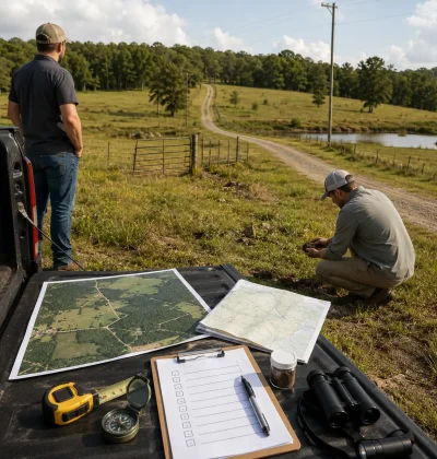
Bring tools that turn a walk into a real inspection: a smartphone with a GPS and mapping app, the parcel’s plat map or survey, sturdy boots, and ideally a handheld GPS or a mapping app loaded with the boundaries. Add a shovel for a quick soil dig, a notepad, and a camera for documentation.
Plan to spend real time and walk the entire parcel, not just the accessible edge. Go after rain if you can, because that is when drainage and access problems show themselves. Check your cell signal while you stand there, note the drive time from town, and photograph anything that raises a question. The 15 points below are what to examine once your boots are on the ground.
1. Legal and physical access
Confirm you can both legally and physically reach the parcel, because access is the single most important thing to verify on rural land. Physical access means a road or driveable route actually reaches the property. Legal access means you have a recorded right to use that route, through public road frontage or a deeded easement across another owner’s land.
A parcel can have a visible dirt track and still be landlocked on paper, which is a serious and expensive problem. Look for a maintained public road touching the parcel, and confirm any access across neighboring land is in writing. If the only way in crosses a neighbor’s property with no recorded easement, treat it as a major red flag until a title search proves otherwise.
2. Road condition and year-round access
Check whether the access road is usable in every season, not just on a dry summer day. Many rural roads are gravel, dirt, or seasonal, and a route that is fine in July can be impassable mud in spring or blocked by snow in winter. Ask who maintains the road and whether it is county-maintained or a private road you would help pay to upkeep.
Drive the full approach yourself and look for washouts, deep ruts, steep unpaved grades, and low water crossings that flood. A parcel you cannot reach for months at a time is worth far less than the listing suggests, and emergency access, mail, and deliveries all depend on a road that works year round.
3. Boundary lines and corner markers
Walk the boundaries and find the corner markers so you know exactly what you are buying. Rural parcels often have unclear or unmarked lines, and it is common for fences, driveways, or outbuildings to sit in the wrong place. Use your plat map and GPS to trace the perimeter and look for survey pins, iron stakes, or marked trees at the corners.
If you cannot locate the corners, or a fence clearly does not match the map, note it and plan to order a survey before closing. Boundary confusion leads to disputes with neighbors and, occasionally, to discovering the parcel is smaller or shaped differently than advertised. Knowing the true lines also tells you where the usable area really is.
4. Buildable area and topography
Walk the terrain to find the usable, buildable portion, because acreage on paper is not the same as ground you can use. Look for level to gently sloping areas with good drainage that could hold a home, barn, or septic field. Note steep slopes, rock outcrops, ravines, and low wet areas that subtract from the usable acreage.
A 20-acre parcel with only 3 flat, dry, buildable acres is priced closer to a small lot than a large tract. Slope also drives cost, since hillside building means retaining walls, longer driveways, and engineered foundations. Stand where you would build and picture the driveway, the well, and the septic field all fitting on the ground you can actually use.
5. Water sources and drainage
Assess how the parcel gets water and where water goes after it rains, since water is make-or-break on rural land. Look for existing wells, springs, ponds, creeks, or nearby water lines, and ask what neighbors use for water and how deep their wells run. On raw land with no municipal supply, a well is usually the only option, and drilling cost rises with depth.
Because private wells are not regulated the way city water is, the private well owner is fully responsible for testing and treating the water for safety. Also study drainage: standing water, cattails, or soggy ground signal poor drainage or wetlands, while gullies and bare eroded soil signal runoff problems. You want reliable water you can drink and ground that sheds rain without flooding your building site.
6. Soil quality and perc feasibility
Dig into the soil and gauge whether it will support building, septic, and anything you plan to grow. Grab a shovel and check whether the ground is topsoil over workable earth or thin dirt over solid rock, which makes wells and foundations costly. For agricultural plans, soil productivity is the single biggest value driver.
You can research the exact soil types for any parcel through the USDA Web Soil Survey before you even visit, then confirm on the ground. Poor, rocky, or waterlogged soil limits building and farming alike, while deep, well-drained soil expands your options. Soil is also the foundation of the next point, whether the land can pass a septic test.
7. Flood zone and erosion signs on the ground
Look for physical evidence of flooding and erosion, and cross-check the FEMA flood maps. On the ground, watch for debris lines on trees or fences, water-stained rocks, fresh silt deposits, carved gullies, and vegetation that only grows in wet areas. These tell you where water has been, regardless of what the seller says.
Then confirm against the maps, since a parcel inside a FEMA Special Flood Hazard Area faces building restrictions and flood insurance requirements that cut its value. Some flooding is seasonal and manageable, and some ground is simply unbuildable. Knowing before you buy lets you price the risk or walk away, rather than discovering it after the first heavy storm.
8. Utilities distance
Measure how far the nearest utilities are, because extending them is often the biggest hidden cost on rural land. Look for the closest power pole and note the distance to the parcel, since running electricity even a half mile can cost tens of thousands of dollars. Check for natural gas lines, and if none exist, factor in propane.
Ask the seller and the local utility what it would cost to connect. A parcel that looks affordable can become expensive once you add power, water, and septic. For off-grid buyers this matters less, but for anyone planning to build conventionally, utilities distance directly changes what the land is worth to you. Get real numbers before you fall in love with the view.
9. Cell signal and internet
Check your cell signal and research internet options while you are standing on the land. Pull out your phone and see how many bars you get in different spots, because rural coverage varies wildly and dead zones are common. If you plan to live, work, or even just call for help from the property, reliable signal matters more than most buyers expect.
Ask about wired internet, fixed wireless, or satellite availability in the area, since remote parcels may have no broadband at all. For recreational land this may not matter, but for a homesite or anyone working remotely, poor connectivity is a real limitation. It is far easier to check now than to discover after you build.
10. Septic and sewer feasibility
Determine whether the parcel can support a septic system, because rural land almost never has municipal sewer. The key test is the soil percolation test, or perc test, which measures how fast water drains and whether the ground can handle a conventional septic field. Land that fails perc may need an expensive engineered system or may not be buildable for a home at all.
Ask whether a perc test has been done, and if not, make your purchase contingent on one. The septic system rules and required setbacks vary by county, so check local health department requirements too. A parcel with a recent passing perc test on file is worth more and removes the biggest unknown for any buyer who intends to build.
11. Neighbors and surrounding land use
Study what surrounds the parcel, because you are buying the neighborhood as much as the land. Drive the area and look at adjacent properties: are they well-kept homesteads, active farms, industrial operations, hunting camps, or junk-strewn lots? Nearby feedlots, quarries, shooting ranges, or planned development can all affect your enjoyment and resale value.
Look also for signs of future change, like survey stakes on neighboring land, new roads, or utility expansion, which can mean development is coming. Talk to neighbors if you can, since they often share what no listing will, from road maintenance headaches to seasonal nuisances. The land itself may be perfect, but the surroundings decide whether you will actually want to be there.
12. Trees, timber, and vegetation
Examine the trees and ground cover, since they carry both value and cost. Marketable timber is a real asset that a buyer or logger will pay for, while dense brush and invasive species mean clearing expense before you can build or farm. Note the mix of open ground and woods against what you plan to do.
Vegetation is also a clue to conditions. Cattails and willows signal wet ground, healthy hardwoods suggest good soil, and dead or stressed trees can indicate drainage or contamination problems. In fire-prone regions, heavy brush near a building site raises wildfire risk and insurance cost. Read the plants, because they quietly describe the land’s water, soil, and history.
13. Wildlife, hunting, and recreation signs
Look for signs of wildlife and recreation potential, especially if that is part of why you are buying. Game trails, tracks, droppings, rubs, and water sources tell you whether the parcel supports deer, turkey, or other game. For hunting and recreational buyers, active wildlife adds real value and enjoyment.
At the same time, note any protected species habitat, since endangered-species designations can restrict what you are allowed to do with the land. Wetlands that attract waterfowl may also carry federal building limits. Match what you see to your goals: abundant game is a plus for a hunting tract, but a protected-species wetland may limit a homesite. The same feature can be an asset or a constraint depending on your plan.
14. Easements, encroachments, and shared roads
Look for anything crossing the parcel that gives someone else rights or reveals a conflict. Power lines, pipelines, well-worn paths, and shared driveways often signal an easement that lets a utility or a neighbor use part of your land. Encroachments, like a neighbor’s fence, shed, or driveway sitting over the line, are equally important to spot on site.
These do not always kill a deal, but you must know about them before you buy. A utility easement may limit where you can build, and a shared road usually comes with shared maintenance obligations. Photograph anything crossing the land and confirm it against the title work later. What you see on the ground should match what the paperwork says, and gaps between the two are worth investigating.
15. Noise, smells, and nuisances
Stand quietly and use your ears and nose, because nuisances are invisible in photos but obvious in person. Listen for highway traffic, rail lines, aircraft, gunfire from a nearby range, or the constant hum of an industrial operation. Smell the air for feedlots, landfills, or agricultural odors that drift on the wind.
Visit at different times if you can, since a peaceful morning parcel can sit under a flight path or next to a facility that runs at night. These factors shape daily life on the land and its resale appeal, yet they never show up in a listing. A few minutes of quiet attention on site can reveal a dealbreaker that no document would ever mention.
Red flags that should make you walk away
Some findings are serious enough to stop a purchase, and recognizing them saves you from a parcel you can never use. The clearest walk-away signals are no legal access with no path to an easement, a building site entirely inside a floodplain, soil that fails perc with no affordable septic alternative, and an active boundary or title dispute with a neighbor.
Other strong warnings include utilities so far away that connection costs exceed the land’s value, evidence of contamination, and a seller who dodges questions about access, water, or liens. None of these are visible in a listing photo, which is exactly why the on-site inspection matters. Being willing to walk away from a flawed parcel is what lets you buy a good one with confidence.
What to verify off-site after your visit
After the field inspection, confirm on paper what your eyes suggested, because the two must agree before you close. Order or review a title search, the recorded survey, the zoning and permitted uses, any liens or back taxes, and the flood and soil reports. This desk-side due diligence is the companion to your site visit, and skipping it is how buyers get surprised at closing.
Compare your inspection notes to the documents line by line, and make your offer contingent on a survey and a perc test if those are not already done.
Well-documented parcels, the kind sellers create when they properly list their land with access, utilities, and survey details included, make this step far easier. To sanity-check the asking price against what you found, compare it with similar rural land listings in the same county before you negotiate.
Rural land inspection scorecard
Use this quick scorecard to rate a parcel after your visit. If any item in the first three rows fails, think hard before proceeding.
| Inspection point | Pass signal | Red flag |
| Legal access | Recorded frontage or easement | Landlocked, no easement |
| Flood and drainage | Outside SFHA, sheds water | Floodplain, standing water |
| Septic and soil | Passing perc, workable soil | Failed perc, solid rock |
| Utilities distance | Power at or near the road | Miles from any service |
| Road and access | County-maintained, year-round | Seasonal, washed out |
| Boundaries | Corners found, match plat | Missing pins, fence disputes |
| Surroundings | Compatible neighbors | Feedlot, quarry, junk lots |
Once a parcel clears the scorecard, an instant land estimate helps you check whether the asking price matches what comparable parcels actually sell for, so your inspection and your offer line up.
Start your rural land search with confidence
Run every parcel through this 15-point inspection, then confirm the paperwork, and you will buy rural land that fits your plans instead of inheriting someone else’s problem. The field walk and the desk-side due diligence together are what separate a smart purchase from an expensive regret. If you want a second opinion before you commit, you can get in touch with our team.
When you are ready to find parcels worth visiting, you can create a free account and search vacant land on a platform built for buyers. And if you already own rural land you want to move on from, the same marketplace lets you reach buyers directly with affordable listing plans and zero commission.
Frequently asked questions
What is the most important thing to check when buying rural land?
Legal access is the most important thing to verify, because a landlocked parcel with no recorded right to reach it is extremely hard to use, build on, or resell. A visible dirt road is not enough; you need public road frontage or a deeded easement in writing. Confirm access on the ground and again in the title search before you commit to buying.
Do I need a perc test before buying rural land?
If you plan to build and there is no municipal sewer, yes, a passing perc test is essential because it determines whether the land can support a septic system. If the seller has not done one, make your purchase contingent on a successful perc test. Land that fails perc may require a costly engineered system or may not be buildable for a home at all.
How do I check if rural land floods?
Look for physical signs on the ground, debris lines, silt deposits, erosion gullies, and water-loving plants, then cross-check the FEMA flood maps for the parcel. A property inside a Special Flood Hazard Area faces building restrictions and flood insurance requirements. Visiting after heavy rain is the fastest way to see how the land actually drains before you buy.
Should I walk the entire property before buying land?
Yes, always walk the whole parcel, not just the road frontage. The usable, buildable portion is what you are really paying for, and problems like wet ground, steep slopes, rock, and boundary issues are only visible when you cover the entire property on foot. Bring the plat map and a GPS so you can trace the true boundaries as you go.
What is the difference between a land inspection and land due diligence?
The inspection is the on-site, physical examination of the parcel, access, water, soil, terrain, and surroundings, that you do with your own eyes. Due diligence is the paperwork verification, title, zoning, liens, permits, and survey, that you handle from your desk and through professionals. You need both, because a parcel can look great on the ground and still have problems on paper.
Resources and further reading
- The USDA Web Soil Survey provides detailed soil maps and drainage data to help assess a parcel’s soil and building suitability before a site visit.
- FEMA’s guidance on the Special Flood Hazard Area explains how floodplains are mapped and what requirements may apply to the land.
- The EPA’s guidance for a private well owner outlines the responsibilities involved in using, testing, and maintaining a private water supply.
- This overview of septic systems explains how they work and the maintenance they require.
- A percolation test determines whether the soil is suitable for a septic system.
- This explanation of an easement covers how another person or organisation may gain the legal right to use part of your land.