Key Takeaways
An AI environmental scan does in seconds what used to take days of digging through county maps and federal databases, flagging the issues that quietly kill land deals.
- An AI environmental scanner pulls public data layers, flood zones, zoning, wetlands, soil, and access, and overlays them on your parcel automatically.
- Running a scan before you list lets you disclose accurately, price correctly, and avoid surprises that blow up a sale at closing.
- The four checks that matter most are flood zone, zoning and permitted use, legal access, and wetlands, because each can sharply change value.
- AI is a fast, cheap first screen, not a legal guarantee, so verify any flagged issue against the official source and order a survey when it counts.
- Scanning early turns a hidden risk into a known fact you can address, which builds buyer trust and shortens time on market.
Nothing stalls a land sale faster than a problem the seller did not know about, a parcel in a floodplain, zoned wrong, or missing legal access. An AI environmental scanner for land finds these issues automatically, pulling federal and county data and mapping it to your exact parcel in seconds.
This guide explains what an AI land scan checks, how it works, and why running one before you list protects your price and your timeline. It also covers the honest limits, so you know when AI is enough and when you still need a professional.
Quick verdict: Run an AI environmental scan on any parcel before you list it, because a few minutes of checking flood, zoning, access, and wetlands can save you a collapsed deal later.
Treat the scan as a fast first screen that tells you where to look, then confirm anything it flags against the official federal or county source. For high-stakes issues like access or boundaries, follow the scan with a professional survey.
What is an AI environmental scanner for land?
An AI environmental scanner for land is software that automatically gathers public environmental and regulatory data about a parcel and maps it to that specific property.
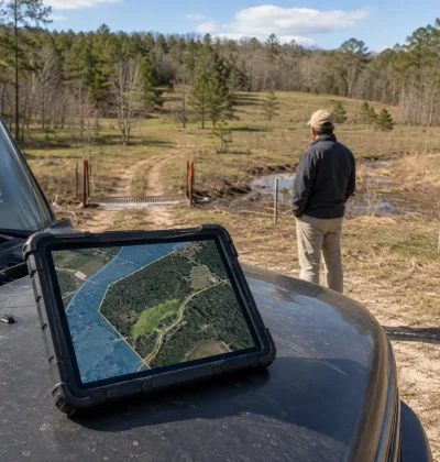
Instead of you visiting a dozen government websites, the tool takes the parcel’s location and boundary, then overlays data layers like FEMA flood maps, county zoning, wetlands inventories, and soil surveys, returning a plain summary of what it found.
The technology behind it is a geographic information system, or GIS, combined with AI that reads and summarizes the results. Where a professional once spent hours cross-referencing maps, an AI scan does the same lookup in seconds and flags the items that affect value or buildability.
It does not replace official records or a survey, but it tells you exactly where to look and what to expect, which is a powerful head start before you list.
Why scan your land before listing it?
Scan before listing so you can disclose accurately, price correctly, and avoid a deal collapsing at closing. Buyers and title companies will run their own due diligence, so any flood-zone status, zoning limit, or access problem will surface eventually. Finding it first puts you in control: you can fix what is fixable, price in what is not, and present the parcel honestly instead of getting caught off guard by a buyer’s inspector.
The payoff is a faster, cleaner sale. A listing that clearly states flood status, zoning, and access answers a buyer’s biggest questions upfront and builds trust, while a hidden problem discovered late wastes weeks and often kills the deal. Scanning early also protects your price, since you can address issues before they become negotiating leverage for the buyer. On an AI land marketplace built around parcel data, surfacing this information early is part of how well-prepared land listings move faster.
What an AI land scan checks: flood zones
Flood zone is the first thing an AI scan checks, because it directly affects value, insurance, and buildability. The scanner pulls your parcel’s status from the federal flood maps and tells you whether any part sits in a Special Flood Hazard Area, the high-risk zones labeled A, AE, or V. Land in these zones typically requires flood insurance on a federally backed loan and may face strict building elevation rules.
Knowing this before you list matters enormously. A parcel wholly outside the floodplain can advertise that as a selling point, while one partly in it should disclose the status and price accordingly. You can confirm any AI flood flag directly on the FEMA Flood Map Service Center, which is the official source of record. If the scan and FEMA disagree, trust FEMA, and remember that flood maps update over time, so a recent check beats an old assumption.
What an AI land scan checks: zoning and permitted use
Zoning determines what a buyer can legally build or do, so an AI scan checks your parcel’s zoning designation and permitted uses against county records. A parcel zoned residential in a housing-short area is worth far more than one zoned conservation where a home may not be allowed, so this single data point can swing value dramatically.
The scanner pulls the zoning classification from the county’s GIS or planning data and summarizes what the land can be used for. That lets you market to the right buyer, whether the parcel suits a homesite, agriculture, or commercial use, and flag any overlay districts, minimum lot sizes, or setback rules that limit development. Because zoning is set locally and changes, always confirm the AI result with the county planning department before you make claims in your listing, especially if a buyer’s plans depend on a specific use.
What an AI land scan checks: legal and physical access
Access is one of the most valuable things an AI scan can flag, because a landlocked parcel is worth a fraction of one with clean access. The scanner looks at whether the parcel touches a public road and whether recorded easements provide a legal route in, surfacing the single defect that most often derails a land sale.
A parcel with recorded road frontage or a deeded easement is far easier to sell and finance than one that relies on crossing a neighbor’s land with no legal right. If a scan flags a possible access problem, treat it as a priority to resolve or disclose, since buyers and lenders will not overlook it. Access is also one area where AI data can be incomplete, so a title search and, ideally, a survey are the reliable way to confirm exactly what rights convey with the parcel.
What an AI land scan checks: wetlands, soil, and terrain
An AI scan also checks wetlands, soil quality, and terrain, since all three affect what a buyer can build and grow. Designated wetlands limit development and can trigger federal permitting, so the scanner flags any wetland areas from the national inventory, drawing on data like the EPA’s wetlands resources. Even a partial wetland designation should be disclosed, because it narrows a buyer’s options.
Soil and terrain round out the picture. The scan can pull soil types and drainage from the USDA Web Soil Survey, which tells buyers whether the ground supports building, septic, and agriculture, and it can flag steep slopes or low, wet areas that reduce usable acreage. None of these replace a perc test or an engineer, but together they give you and your buyer an honest first read on how buildable the parcel really is, before anyone spends money on field work.
How does an AI environmental scanner work?
An AI environmental scanner works by locating your parcel, then overlaying multiple public data layers on it and summarizing the overlaps. It starts from the parcel boundary or address, pulls layers like flood maps, zoning, wetlands, and soil from federal and county sources, and uses AI to translate the raw geographic data into a plain-language report of what applies to your land.
The speed comes from automation. A person checking these sources manually would open FEMA, the county GIS, a wetlands map, and a soil survey one at a time and interpret each. The scanner queries them together and returns results in seconds, flagging anything that affects value or buildability. The quality of the output depends on the quality and currency of the underlying public data, which is why the tool is best treated as a fast, comprehensive first pass rather than the final word. It shows you the full picture quickly so you know exactly what to verify next.
AI scan versus manual due diligence versus a survey
An AI scan, manual due diligence, and a professional survey each play a role, and the smart approach uses them in sequence. The AI scan is the fast, cheap first screen that surfaces every potential issue in one place. Manual due diligence is where you confirm each flag against the official source, and a survey or professional report is where you get legally reliable answers on boundaries and access.
Think of it as a funnel. Start with the AI scan to know what exists, then do the deeper paperwork verification that our raw land due diligence checklist covers, confirming title, zoning, and liens against county and federal records. For anything physical or boundary-related, add the on-site inspection points every buyer checks in person, and order a survey when access or acreage is in question.
AI dramatically shortens the first step, but it is a screen, not a guarantee, and the deals that close cleanly are the ones where a flagged issue was actually verified. If you want an accurate value that reflects these findings, an instant land estimate factors the parcel’s real characteristics into its number.
How to use your scan results before you list
Use the results to fix what you can, disclose what you cannot, and price the parcel accordingly. If the scan flags a resolvable issue like an unrecorded easement, resolving it before you list can meaningfully raise your value. If it flags a fixed constraint like a floodplain or wetland, the right move is honest disclosure and a price that reflects it, which attracts the buyers who want that kind of land anyway.
Then put the findings to work in your listing. Stating flood status, zoning, access, and buildability upfront answers a buyer’s biggest questions and signals that you have nothing to hide, which shortens time on market. Attach or reference the official sources so buyers can verify, and you turn due diligence from a hurdle into a selling point. When you are ready, you can list your land with these details included and presented clearly, so a well-scanned, well-disclosed parcel becomes the one buyers trust and act on.
Scan, disclose, and list with confidence
A parcel you have scanned and disclosed honestly is far easier to sell than one hiding an unknown, because buyers reward transparency and walk away at the first sign of a buried problem. The few minutes a scan takes pay off in fewer surprises, fewer failed closings, and a price you can defend. If a scan turns up something you are unsure about, you can get in touch with our team.
Once your scan is done and your disclosures are clear, you can create a free listing and reach land buyers directly, with affordable listing plans that never take a commission from your sale.
Frequently asked questions
What does an AI environmental scanner check on a parcel?
It checks the environmental and regulatory factors that affect land value and buildability: flood zone status, zoning and permitted use, legal and physical access, wetlands, soil type, and terrain. It pulls these from federal and county data and maps them to your specific parcel. The goal is to flag any deal-affecting issue quickly, so you can verify and address it before listing rather than at closing.
Is an AI land scan as reliable as a survey?
No. An AI scan is a fast, comprehensive first screen based on public data, but it is not a legally reliable substitute for a survey. A survey physically measures boundaries and confirms access and encroachments in a way public map data cannot. Use the AI scan to find potential issues quickly, then order a survey when access, acreage, or boundaries are in question or when a lender requires one.
Can I check a flood zone myself for free?
Yes. The FEMA Flood Map Service Center lets you look up any parcel’s flood zone by address for free, and it is the official source. An AI scanner simply automates that lookup along with zoning, wetlands, and soil in one step. Whether you use a scanner or check manually, always confirm flood status on FEMA directly, since flood maps are periodically updated and older information can be wrong.
Why should I scan my land before listing instead of after?
Scanning first puts you in control. Buyers and title companies will run due diligence anyway, so any flood, zoning, or access issue surfaces eventually. Finding it early lets you fix what you can, disclose the rest, and price accurately, rather than having a buyer discover it and use it as leverage or walk away. Early disclosure builds trust and shortens time on market.
Does a flood zone or wetland make my land worthless?
No, but it does affect value and the right buyer. Floodplain and wetland parcels face building limits and, for flood zones, insurance requirements, which lower value for development. However, many buyers specifically want recreational, conservation, or hunting land where these features are fine or even desirable. The key is honest disclosure and pricing that matches the land’s realistic use, which attracts the buyers who value it.
Resources & Further Reading
- The FEMA Flood Map Service Center is the official tool for checking any parcel’s flood zone by address.
- The USDA Web Soil Survey provides detailed soil and drainage data for any parcel in the country.
- The EPA’s wetlands resources explain how wetland designations affect what you can build.
- This overview of zoning explains how permitted-use rules shape what land can become.
- Understanding an easement clarifies the legal access that a landlocked parcel often lacks.
- A geographic information system is the mapping technology that powers an automated parcel scan.